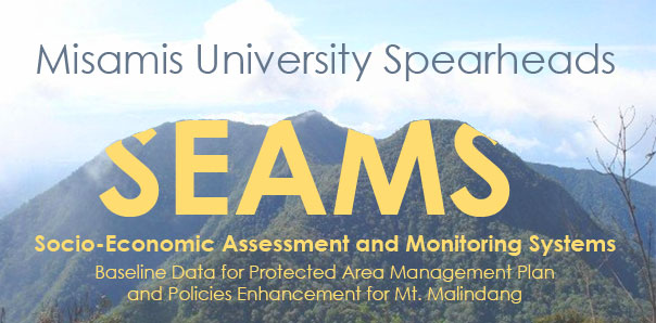
Socio-Economic Assessment and Monitoring Systems (SEAMS): Baseline Data for Protected Area Management Plan and Policies Enhancement for Mt. Malindang was spearheaded by Misamis University

Misamis University conducted the Socio-Economic Assessment and Monitoring Systems (SEAMS) which was funded by the DENR-Protected Area Office Region 10. It was successfully completed last November 2019. SEAMS is a tool developed by the Department of Environment and Natural Resources (DENR) for the comprehensive socio-economic assessment suitable not only for terrestrial protected areas but also for coastal or marine protected areas. Through SEAMS, the Protected Area (PA) implementers will be provided with a comprehensive demographic, socio-cultural, economic, physical and institutional profile of communities in protected areas. These profiles will be presented to the PAMB for the formulation and enhancement of PA management plans and policies. The assessment was conducted in 8 barangays in the Municipality of Don Victoriano Chiongbian namely, Napangan, Tuno, Lalud, Gandawan, Nueva Vista, Liboron, Lake Duminagat, and Lampasan, and Sebucal of Oroquieta City.
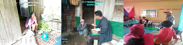
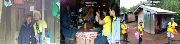
| Above Left: Mrs. Virgincita Powao from Brgy. Tuno was weighing her Chayotes prior to delivery to the middle man in their barangay. Middle to right: Mr. Bobby B. Alaman was interviewing a resident in Barangay Liboron while Mr. Eden C. Pito was conducting a Focus Group Discussion (FGD) in Brgy. Gandawan on the existing threats and their causes in Mt. Malindang (right photo). |
The group who conducted the assessment was spearheaded by the Misamis University Community Extension Program (MUCEP) led by the Director, Alfredo F. Garrido Jr., together with the MUCEP personnel Eden C. Pito, Bobby B. Alaman, Jersam C. Calago, Goldah Grace D. Sultan, Yunalyn L. Villantes and Hanzen D. Tomatao. Also, College of Arts and Sciences (MUCAS) and College of Business and Management (MUCBM) were involved in this project. There were also enumerators that were hired namely, Chyremar L. Caylaluad, Rutchel C. Becada, Eugene V. Villantes, Erlu J. Daguman, Kalvin Klein D. Abellar, Israel B. Calimpong, Jay Arn O. Navarro Jr., and Jayne Coleen C. Padua. The team were divided into two groups wherein the 1st group geo-tagged the existing farm lots of the residents within the PA, while the other group interviewed the household heads using the SEAMS questionnaire. The assessment covered all of the occupants inside the PA as well as those who are residing in the buffer zones and all those who are dependent on resource utilization inside the PA for subsistence and livelihood. The specific objectives of the assessment were the following: (1) to characterize the socio-economic condition of occupants in the PAs and nearby areas; (2) to identify and locate sources and values of the various ecosystems in the PAs, (3) to determine the degree of degradation/improvement in ecosystem services, uses and values, (4) to identify ecosystem pressures and threats, and their causes.
| Below, left: Jay Arn, Navarro, one of the enumerators, posed with the household head from Barangay Napangan after the interview. A sticker is also visible above their head which was glued in the front portion of house that serves an indicator that the household has been interviewed and geo-tagged. Middle: Ms. Rutchel Becada and Ms. Jayne Coleen Padua, both enumerators, were interviewing a resident in Barangay Nueva Vista. Enumerators were about to go to their assigned households to conduct the interview and geo-tag the houses. |
This undertaking was made possible with the continuous partnership between the Misamis University under the leadership of the dynamic President, Dr. Karen Belina F. De Leon and the Department of Environment and Natural Resources- Protected Area Office (DENR- PAO 10) led by the PENRO and Concurrent PASu Mr. Rey Fernandez. Also, the participation and support of the Mayors and Barangay Officials of the aforementioned barangays were duly recognized in making this endeavour successful.
Announcement

|

|

|
Photo Gallery

|
|

|
Videos

|

|

|